Photomapping is the preferred supplier to government and industry for timely and accurate spatial data throughout Australia and New Zealand.

Aerial Imagery & Mapping
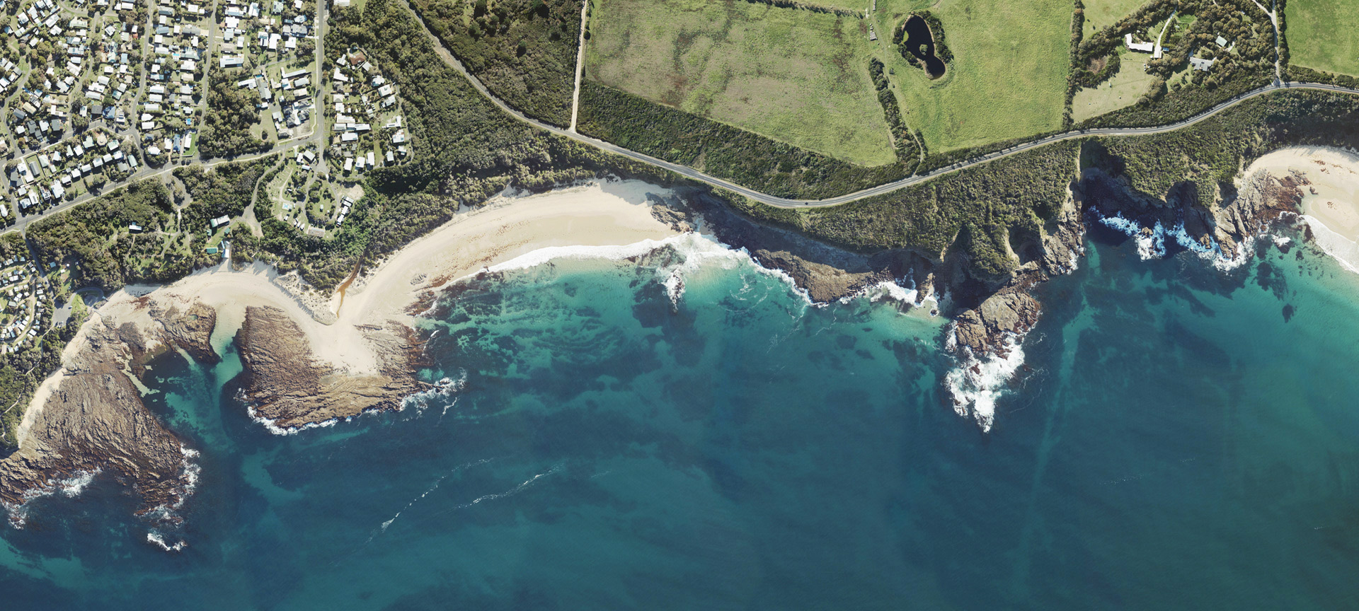
We are experts in acquiring and producing high-resolution imagery and photogrammetric products for projects across Australia and New Zealand. Our flight capacity is second to none, with a fleet of fixed-wing twin-engine aircraft fitted with cutting-edge large-format digital sensor systems. These sensors have four band capability (RGBNiR), the fourth band providing near-infrared (NiR) wavelength in the electromagnetic spectrum. Invisible to the human eye, NiR is a valuable tool for image analysis and change detection – particularly for those applications involving vegetation and wetlands.
Airborne LiDAR
We offer the latest LiDAR technology to service terrain modelling and monitoring requirements. Our aircraft mounted LiDAR systems simultaneously collects dense 3D point cloud and high-resolution digital imagery, avoiding temporal variation between imagery and LiDAR based data products. Our experienced LiDAR team process your surveyed point cloud into an accurate 3D data set allowing for the creation of derived products such as DEMs, DTMs, canopy and foliage cover models and 3D visualisations. LiDAR and its derived products are suitable to service a wide range of terrain modelling, environmental monitoring, infrastructure development and traditional aerial survey project requirements.
Using smart people and scalable cloud-based processing, we provide exceptional value for clients across Local, State and Federal Government, natural resources and infrastructure sectors.
+60%
aircraft hours in the past 12 months
0.5
petabytes of spatial data delivered online to our clients in the past 12 months
0
safety incidents in the past 12 months
Photomapping Services has been acquired by Revelare.
Revelare is a full-service geospatial company, combining the intelligence and capability of established and trusted service providers like Photomapping. 100% Australian owned, Revelare delivers expertise and capability across hydrographic, topographic and data analytics.
Photomapping will continue to collect, process and deliver exceptional aerial imagery and LiDAR solutions to new and existing clients under the Revelare brand.
Read more


We are 100% Australian owned and have been supporting the geospatial industry across Australia and New Zealand since 1969.