Our large-format digital sensors deliver four band capability (RGBNiR) for image analysis and change detection.
Products we offer
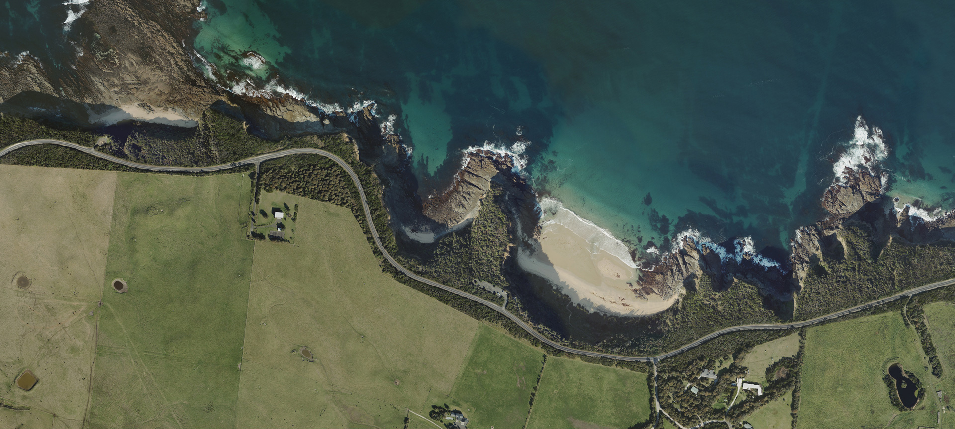
We are experts in acquiring and producing high-resolution imagery and photogrammetric products. Our aircraft-mounted imagery system collects broad areas at varying image resolutions. An experienced team of spatial analysts processes your surveyed images into an accurate image data set allowing for customised solutions, including:
- Orthophoto: a scale-corrected 2D aerial photographic map that provides a comprehensive background and is often used to interpret and supplement other data types and thematic layers. Scale distortions due to tip and tilt of the camera at the time of exposure, and relief displacement, the rise and fall of the terrain, are removed from the imagery prior to publication as an orthophoto.
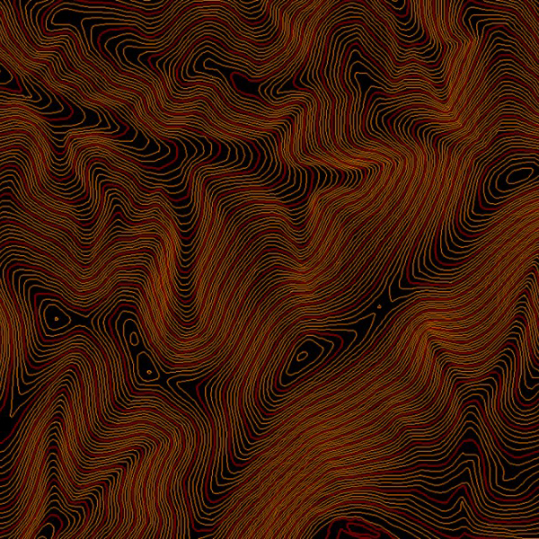
- Digital Terrain Model (DTM): a representation of the ‘bare-earth’ terrain surface that is used in the production of other data types such as orthophotos, and is an important stand-alone product, enabling calculation of volumes (cut-and-fill / stockpile).
- Photogrammetric Mapping: collection of data for the generation of 2D and 3D digital models. These are vector products that support cartographic representation of the real world.
How aerial imagery is used
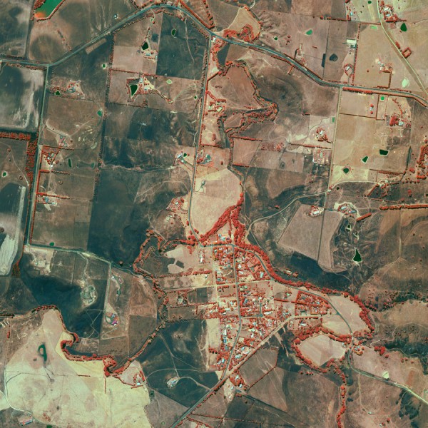
An orthophoto in Geographic Information Systems (GIS) is a precise georeferenced image layer of a 2D environment. These are widely used in urban planning, mining, infrastructure development, property development, civil and water engineering, agriculture, forestry, renewable energies, disaster recovery, insurance and coastal management, to name just a few applications.
Any application which requires accurate data on the shape, size and orientation of landforms needs digital terrain models or DTMs. Having DTMs opens a broad range of applications across civil construction, water services, bushfire modelling, engineering, mining, topographic mapping, recreation, defence and more.
All Photomapping’s image sensors collects 4-Band Imagery (Red, Green, Blue and Near-infrared bands). The fourth band refers to the near-infrared (NiR) wavelength in the electromagnetic spectrum. Invisible to the human eye, it’s a valuable tool for image analysis and change detection. A colour-infrared (CiR), or false colour image, is composed of NiR, red and green bands. By displaying the NiR band as a visible band, the NiR reflectance values can be “seen” and analysed.
CiR is a valuable tool in many industries. In any application that involves quantifying vegetation, assessing vegetation health, identifying individual species of vegetation, and estimating water turbidity and soil moisture – CiR Images provide valuable insights.
Image credit (top of page): Inverloch, Victoria. The copyright in the data and imagery is owned by the State of Victoria and is used with permission.

Our aerial imagery and mapping services puts you in complete control and ensures the data you receive is perfectly suited to your needs.
Contact us today to find out how we can help.