Major Timor Sea survey campaign underway
Building a detailed picture of the seabed
Revelare Hydrospatial has commenced SI 1070, the second phase of a major multi-year survey campaign in the Timor Sea. This project is helping build a more complete understanding of Australia's seabed and marine environment, while generating the hydrospatial intelligence needed to support safer navigation and informed decision-making across Australia's maritime domain.
Delivered on behalf of the Australian Hydrographic Office (AHO) through the HydroScheme Industry Partnership Program (HIPP), the project forms part of a broader campaign spanning almost 5,798 NM² across Australia's northern waters between 2025 and 2028.
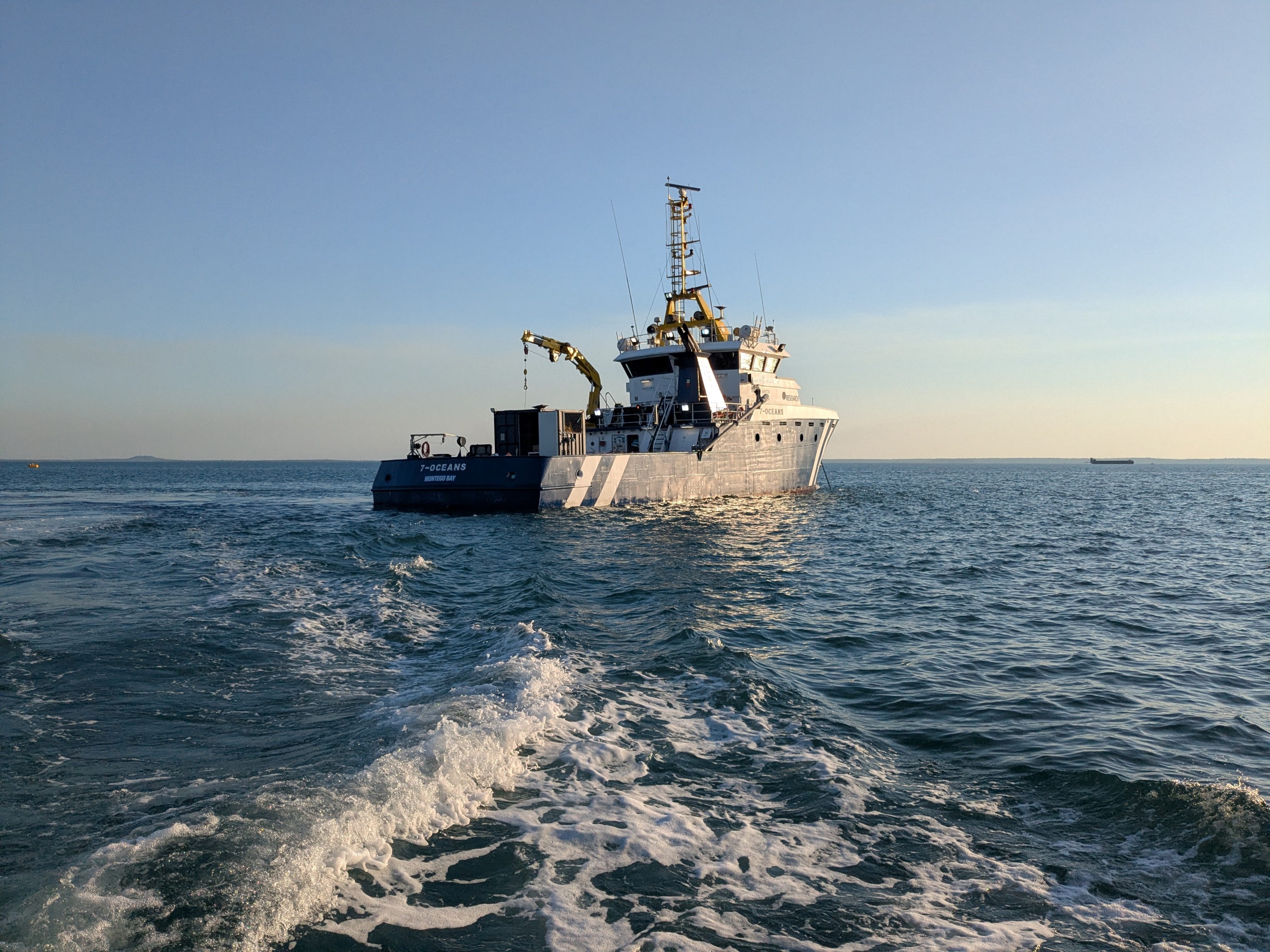
Following the successful completion of SI 1057 in 2025/26, the Revelare Hydrospatial team has returned to the Timor Sea alongside trusted partner One Ocean Group aboard the survey vessel 7-Oceans. SI 1070 extends survey coverage eastward towards Evans Shoal, continuing the collection of modern hydrographic data in a region that supports significant maritime activity and includes environmentally important marine habitats.
While updated nautical charts remain a key outcome, modern hydrographic surveys provide far more than just depth information. The data collected contributes to a growing body of seabed information that supports safer navigation, informed marine planning and a deeper understanding of Australia's maritime domain.
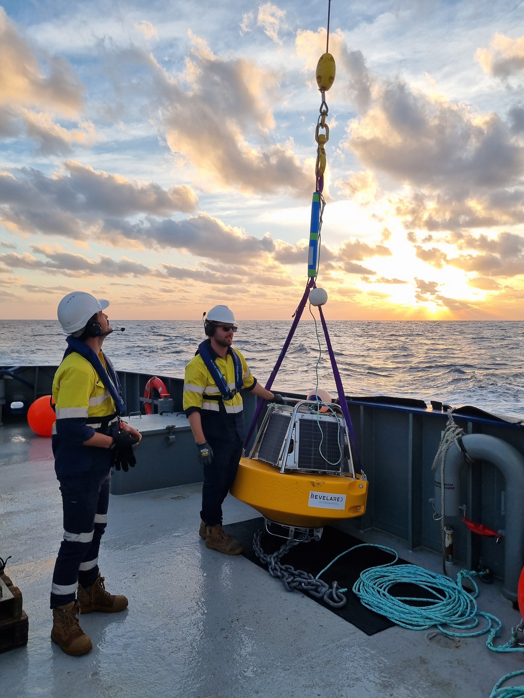
In addition to bathymetric data, the project will collect seabed backscatter and samples, tidal and geodetic observations, and bioluminescence data. Together, these datasets contribute to a richer understanding of the marine environment and support a range of hydrospatial applications beyond chart production.
The first phase of the campaign, SI 1057, surveyed 2,224 NM² and was conducted almost entirely within the Oceanic Shoals Marine Park, an ecologically significant region known for its unique seabed features and diverse marine life. SI 1070 will add a further 1,830 NM² of survey coverage, extending the campaign into a region of significant maritime activity, with the final phase, SI 1071, scheduled to commence in 2027.
Together, the three surveys are progressively replacing legacy survey information with modern, full-coverage multibeam bathymetry. In some parts of the broader survey corridor, the most recent available data dates back to the late 1980s and was acquired using single beam echo sounder systems with survey lines spaced up to a nautical mile apart. The current campaign will provide a far more detailed and comprehensive picture of the seabed, supporting updated navigational products and improved knowledge of the region's physical characteristics.
The updated datasets will provide a far more detailed understanding of seafloor conditions across a strategically important section of the Timor Sea. Beyond supporting navigational safety, the information contributes to a broader understanding of Australia's marine environment and maritime domain.
"At Revelare we are excited to be continuing with our work in the Timor Sea. This is a significant project for the AHO and is of great importance to us as a company.
"It has allowed us to invest in innovation in all aspects of what we do, and after a seamless mobilisation we look forward to completing the offshore acquisition in a safe and efficient manner.
"Good luck to the team and our Surveyor In Charge, Lachlan Stone-Schack."
Dylan Colson, Hydroscheme Program Manager
SI 1070 is being delivered in partnership with One Ocean Group aboard the survey vessel 7-Oceans and is expected to continue through to October 2026.
Continue exploring Revelare Hydrospatial